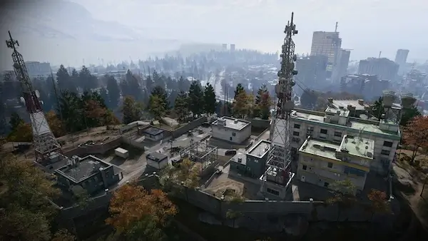
Hajin DMZ Map Guide: All Major POIs and Threat Levels
Explore the Hajin Exclusion Zone in Modern Warfare 4 DMZ, including all major POIs, threat levels, dangerous hotspots, Tac-Map features and key locations to know before deployment.
Hajin is the main Exclusion Zone for Modern Warfare 4 DMZ, combining dense urban districts, military installations, rural farmland, forests, waterways and heavily contaminated areas into one large extraction environment.
Call of Duty has now revealed the official layout of Hajin, including its major Points of Interest, expected Threat Levels and several key locations that will shape how squads plan their deployments.
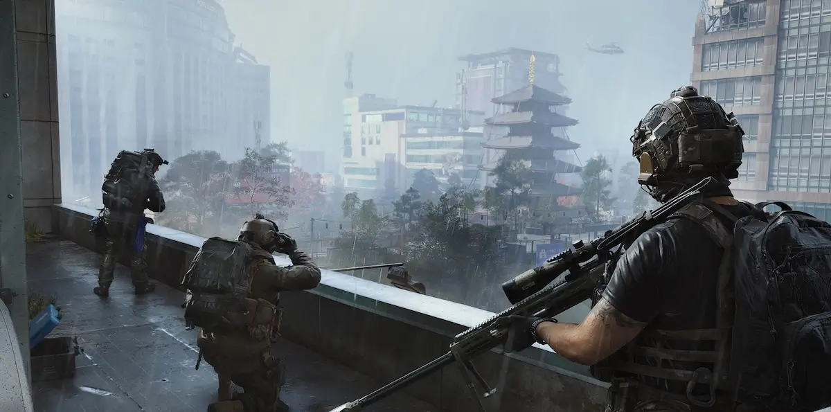 MapHajin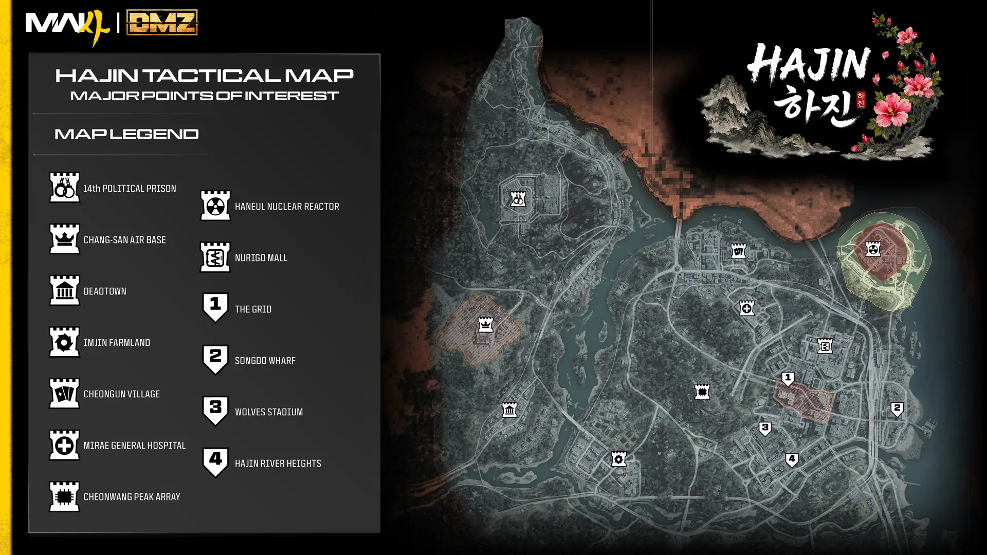
Hajin at a Glance
Hajin is split between very different environments. Operators can move from open farmland and small settlements into forests, fortified military compounds and dense sections of Hajin City, while rivers, roads, rail lines and elevated transport routes connect the wider Exclusion Zone.
The official map also makes one thing immediately clear: danger is not distributed evenly. Some areas are relatively safe entry points, while locations such as Chang-san Air Base , The Grid and parts of the 14th Political Prison can reach Critical or even Extreme Threat Levels.
All 13 Major POIs on the Hajin Map
The official Hajin Tactical Map identifies 13 major Points of Interest. Each occupies a different part of the Exclusion Zone and has its own expected level of enemy resistance.
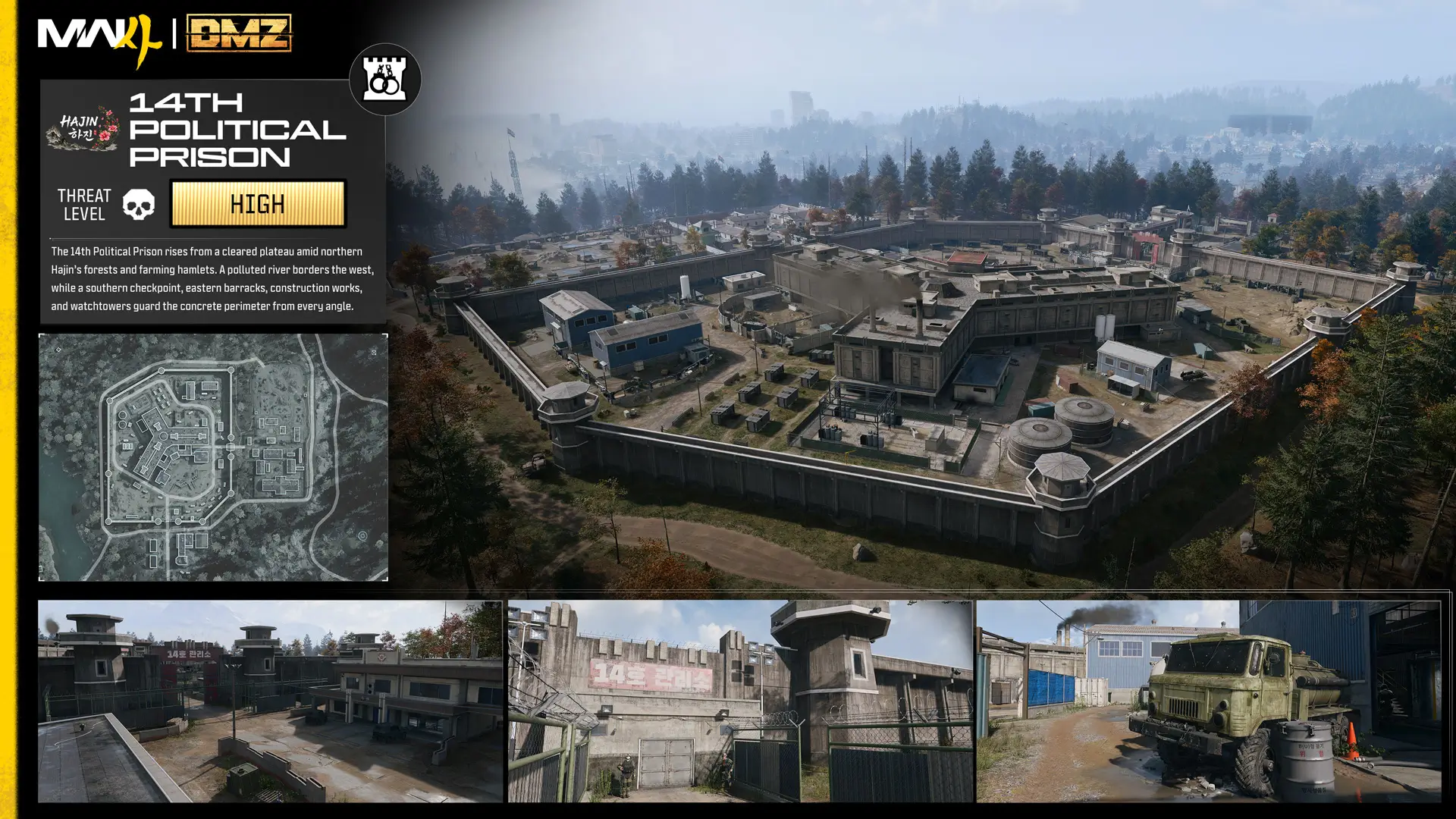
- 14th Political Prison – Northwest Hajin – High
- Chang-san Air Base – Western Hajin – Critical
- Deadtown – Southwest Hajin – Low
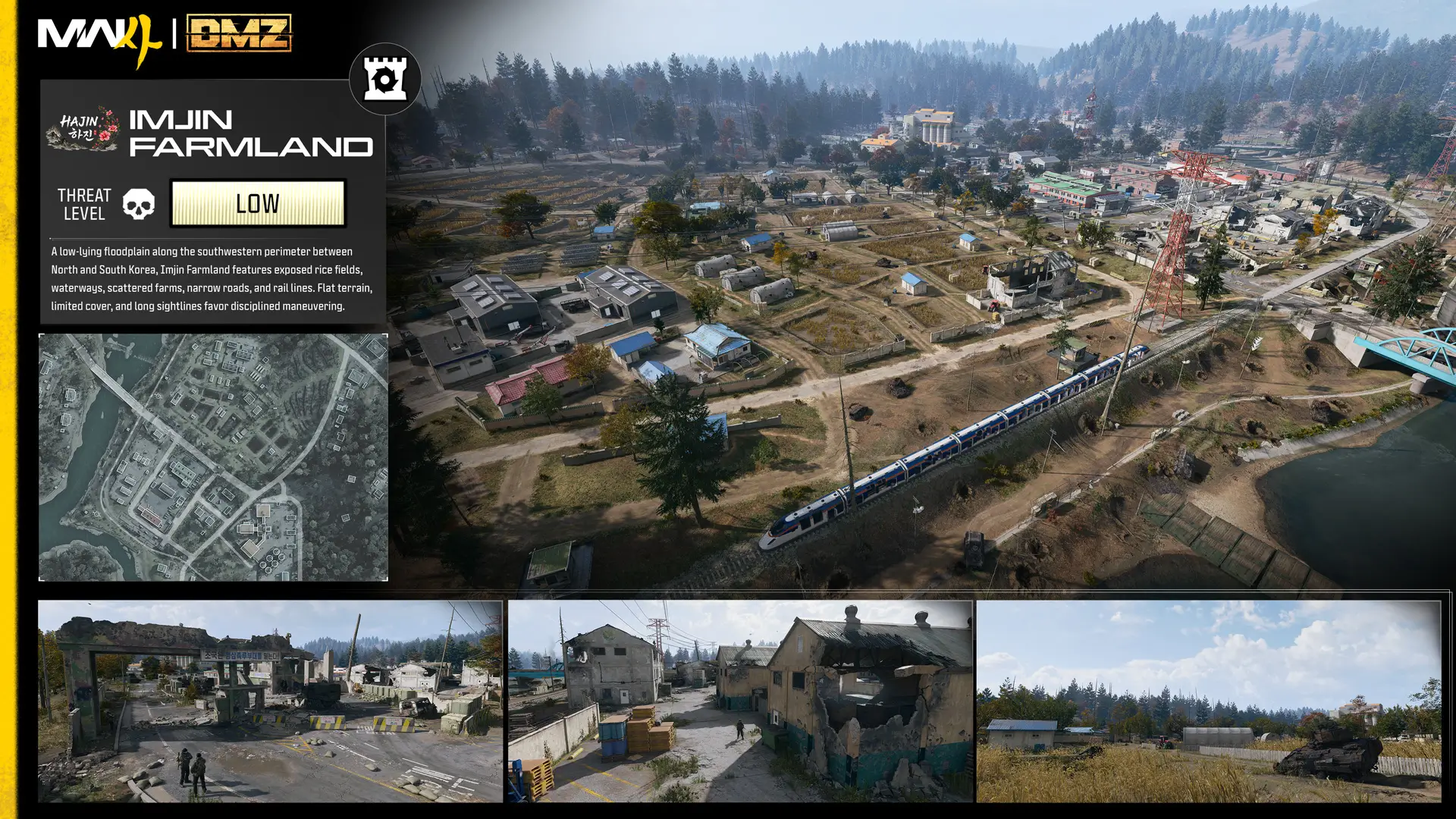
- Imjin Farmland – South-Southwest Hajin – Low
- Cheongun Village – Northern Hajin – Low
- Mirae General Hospital – North Central Hajin – Low
- Cheonwang Peak Array – Central Hajin – Medium
- Haneul Nuclear Reactor – Northeast Hajin – High
- NuriGO Mall – Northeast Hajin City – Medium to High
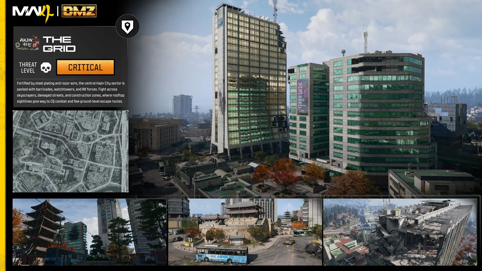
- The Grid – Central Hajin City – Critical
- Songdo Wharf – Eastern Hajin City – Low
- Wolves Stadium – South Central Hajin City – Medium
- Hajin River Heights – Southeast Hajin – Medium
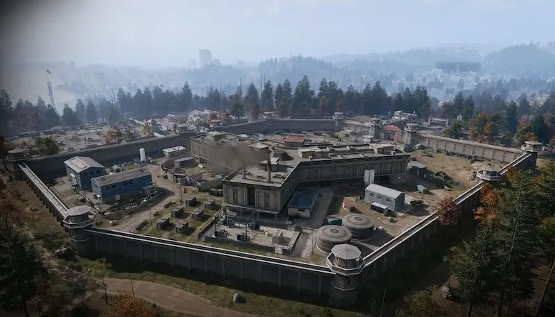 14th Political PrisonLocation · Hajin
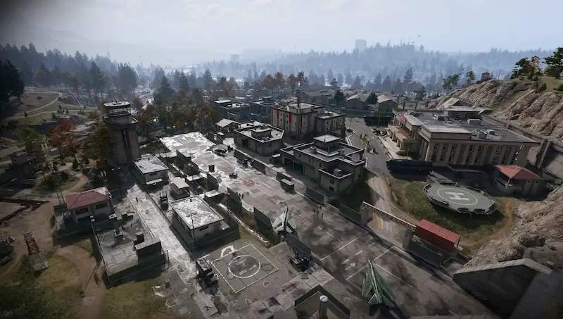 Chang-san Air BaseLocation · Hajin
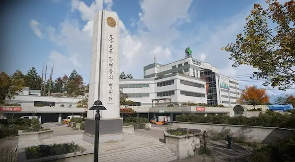 Mirae General HospitalLocation · Hajin
- Cheonwang Peak ArrayLocation · Hajin
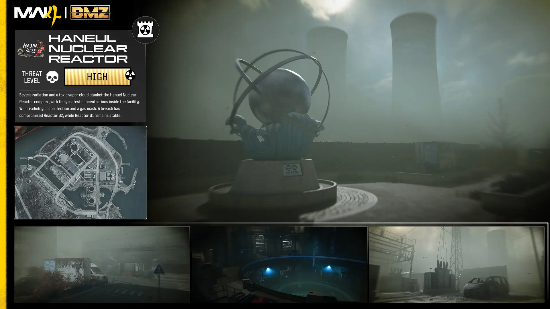
 Haneul Nuclear ReactorLocation · Hajin
The Most Dangerous Areas of Hajin
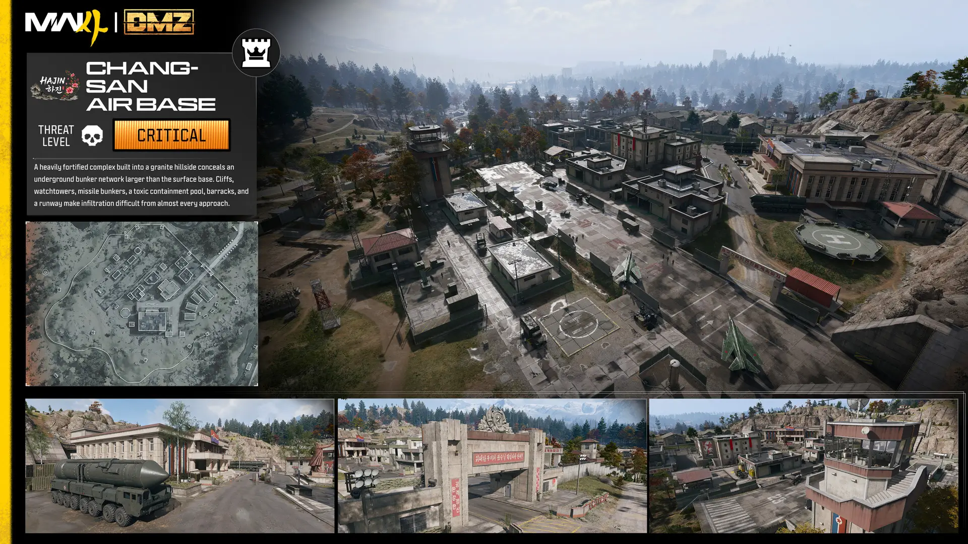
Chang-san Air Base
Chang-san Air Base is one of the most dangerous locations revealed so far. The fortified military complex is built into a granite hillside, while an enormous underground bunker system extends beneath the surface. The exterior is rated Critical, with the bunker reaching Extreme Threat.
Haneul Nuclear Reactor
The Haneul Nuclear Reactor is one of Hajin's most hazardous locations. Heavy radiation covers the facility and surrounding area, making protective equipment and a Gas Mask essential for Operators attempting to explore the site.
The Grid
The Grid forms the fortified heart of Hajin City. Dense streets, skyscrapers, barricades and military positions create a highly vertical urban combat zone with limited escape routes at ground level.
14th Political Prison
The 14th Political Prison dominates northwestern Hajin. The outer prison is already a High Threat area, but squads pushing into the Citadel at its center will enter a Critical Threat zone built around enclosed corridors, elevated walkways and fortified prison structures
Not Every Part of Hajin Is a Death Trap
Hajin also contains lower-threat regions that offer more open terrain and room to maneuver. Imjin Farmland, Cheongun Village, Mirae General Hospital and Songdo Wharf all begin at Low Threat, though individual buildings or nearby objectives can still be considerably more dangerous.
How the Hajin Tac-Map Works
The in-game Tac-Map displays far more than terrain. It tracks mission objectives, major POIs, enemy compounds, important buildings, Ammo and Armor Caches, radiation, pings and other operational information across Hajin.
Hajin also uses a coordinate grid with letters running from west to east and numbers running from north to south. These coordinates can be used to communicate locations with squadmates, and Keys found during deployments include their relevant grid location in the description.
How Threat Levels Work
Each Point of Interest has an expected Threat Level that indicates how dangerous the local enemy response is. Higher Threat Levels generally mean stronger and more numerous hostile forces, and aggressive actions can escalate the situation further.
Hajin Has More Than 60 Named Locations
The 13 major POIs are only the beginning. Call of Duty confirms that Hajin contains more than 60 named locations, including smaller settlements, landmarks and operational sites scattered between the main districts.
The Tac-Map also identifies functional locations such as Gas Stations, Fire Stations, Police Stations, Clinics, Exfil sites, Ammo and Armor Caches, UAV Towers, Compounds, Bounty Stations, SAM Sites and Lieutenant Hunt towers.
Explore Hajin on the DMZHUB Interactive Map
The DMZHUB Hajin Interactive Map will bring these locations together in one searchable, filterable map built specifically for DMZ. The map page is already available and will be expanded as soon as the necessary in-game map data becomes available.
MapHajinSource
Official source: Call of Duty – DMZ Deep Dive, Part 1: Tour of Duty – Hajin Environments and Threats, Full Intel Guide, published October 5, 2026.